osm plugin for flutter apps (only Android for now, iOS will be supported in future)
- current position
- change position
- tracking user location
- customize Icon Marker
- assisted selection position
- draw Road,recuperate information (duration/distance) of the current road
- ClickListener on Marker
- calculate distance between 2 points
- address suggestion
- draw shapes
- simple dialog location picker
Add the following to your pubspec.yaml file:
dependencies:
  flutter_osm_plugin: ^0.7.3-nullsafety.0
OSMFlutter(
controler:mapController,
currentLocation: false,
road: Road(
startIcon: MarkerIcon(
icon: Icon(
Icons.person,
size: 64,
color: Colors.brown,
),
),
roadColor: Colors.yellowAccent,
),
markerIcon: MarkerIcon(
icon: Icon(
Icons.person_pin_circle,
color: Colors.blue,
size: 56,
),
),
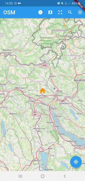
initPosition: GeoPoint(latitude: 47.35387, longitude: 8.43609),
);
 MapController controller = MapController(
                            initMapWithUserPosition: false,
                            initPosition: GeoPoint(latitude: 47.4358055, longitude: 8.4737324),
); controller.dispose();| Properties | Description |
|---|---|
initMapWithUserPosition |
(bool) initialize map with user position (default:true |
initPosition |
(GeoPoint) if it isn't null, the map will be pointed at this position |
GlobalKey was deprecated
await controller.currentPosition(); await controller.zoom(2.);
// or
await controller.zoomIn(); await controller.zoom(-2.);
// or
await controller.zoomOut(); await controller.enableTracking(); await controller.disabledTracking();this method will create marker on that specific pisition
await controller.changeLocation(GeoPoint(latitude: 47.35387, longitude: 8.43609));await controller.goToLocation(GeoPoint(latitude: 47.35387, longitude: 8.43609)); GeoPoint geoPoint = await controller.myLocation();- we have 2 way to select location in map
- manual selection
GeoPoint geoPoint = await controller.selectPosition();- assisted selection (for more details see example)
 /// To Start assisted Selection
 await controller.advancedPositionPicker();
 /// To get location desired
  GeoPoint p = await controller.getCurrentPositionAdvancedPositionPicker();
  /// To get location desired and close picker
 GeoPoint p = await controller.selectAdvancedPositionPicker();
 /// To cancel assisted Selection
await controller.cancelAdvancedPositionPicker();- PS : selected position can be removed by long press
await controller.removePosition(geoPoint);- PS : static position cannot be removed by this method
 RoadInfo roadInfo = await controller.drawRoad(
   GeoPoint(latitude: 47.35387, longitude: 8.43609),
   GeoPoint(latitude: 47.4371, longitude: 8.6136),
   roadColor : Colors.green,
   roadWidth : 7.0,
);
 print("${roadInfo.distance}km");
print("${roadInfo.duration}sec"); await controller.removeLastRoad();you can use it if you don't have at first static position and you need to add staticPoints with empty list of geoPoints you can use it to change their position over time
await controller.setStaticPosition(List<GeoPoint> geoPoints,String id );- Circle
 /// to draw
 await controller.drawCircle(CircleOSM(
              key: "circle0",
              centerPoint: GeoPoint(latitude: 47.4333594, longitude: 8.4680184),
              radius: 1200.0,
              color: Colors.red,
              strokeWidth: 0.3,
            ));
 /// to remove Circle using Key
 await controller.removeCircle("circle0");

 /// to remove All Circle in the map
 await controller.removeAllCircle();
- Rect
 /// to draw
 await controller.drawRect(RectOSM(
              key: "rect",
              centerPoint: GeoPoint(latitude: 47.4333594, longitude: 8.4680184),
              distance: 1200.0,
              color: Colors.red,
              strokeWidth: 0.3,
            ));
 /// to remove Rect using Key
 await controller.removeRect("rect");

 /// to remove All Rect in the map
 await controller.removeAllRect();
- remove all shapes in the map
await controller.removeAllShapes();| Properties | Description |
|---|---|
trackMyPosition |
enbaled tracking user position. |
showZoomController |
show default zoom controller. |
markerIcon |
set icon Marker |
defaultZoom |
set default zoom to use in zoomIn()/zoomOut() (default 1) |
road |
set color and start/end/middle markers in road |
useSecureURL |
enabled secure urls |
staticPoints |
List of Markers you want to show always ,should every marker have unique id |
onGeoPointClicked |
(callback) listener triggered when marker is clicked ,return current geoPoint of the marker |
onLocationChanged |
(callback) it is hire when you activate tracking and user position has been changed |
showDefaultInfoWindow |
(bool) enable/disable default infoWindow of marker (default = false) |
isPicker |
(bool) enable advanced picker from init of the map (default = false) |
 double distanceEnMetres = await distance2point(GeoPoint(longitude: 36.84612143139903,latitude: 11.099388684927824,),
GeoPoint( longitude: 36.8388023164018, latitude: 11.096959785428027, ),);you should know that i'm using public api, don't make lot of request
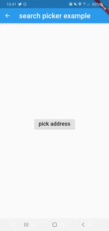
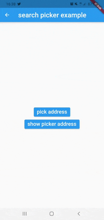
List<SearchInfo> suggestions = await addressSuggestion("address");simple dialog location picker to selected user location
GeoPoint p = await showSimplePickerLocation(
                      context: context,
                      isDismissible: true,
                      title: "Title dialog",
                      textConfirmPicker: "pick",
                      initCurrentUserPosition: true,
                    )
for now the map working only for android,iOS will be available soon
if you get ssl certfiction exception,use can use http by following instruction below
if you want to use http in Android PIE or above :
-
enable useSecureURL and add
android:usesCleartextTraffic="true"in your manifest like example below :<application ... android:usesCleartextTraffic="true">
if you faced build error in fresh project you need to follow those instruction ([#40])
1) remove flutter_osm_plugin from pubspec, after that pub get
2) open android module in android studio ( right click in name of project -> flutter-> open android module in android studio)
3) update gradle version to 4.1.1 ( IDE will show popup to make update)
4) update kotlin version to 1.4.21 & re-build the project
5) re-add flutter_osm_plugin in pubspec , pub get ( or flutter clean & pub get )