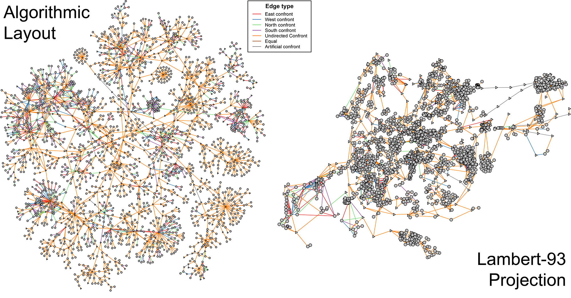
Reconstruction of the map of Avignon during medieval times
- Copyright 2020-2024 Vincent Labatut & Margot Ferrand
MedievalAvignon is free software: you can redistribute it and/or modify it under the terms of the GNU General Public License as published by the Free Software Foundation. For source availability and license information see licence.txt
- Lab site: http://lia.univ-avignon.fr/
- GitHub repo: https://github.com/CompNet/MedievalAvignon
- Data: https://doi.org/10.5281/zenodo.12804379
- Contact: Vincent Labatut [email protected], Margot Ferrand [email protected]
If you use this source code or the associated dataset, please cite reference [FL'24].
@Article{Ferrand2025,
  author    = {Ferrand, Margot and Labatut, Vincent},
  title     = {Approximating Spatial Distance Through Confront Networks: Application to the Segmentation of Medieval {A}vignon},
  journal   = {Journal of Complex Networks},
  year      = {2025},
  volume    = {13},
  number    = {1},
  pages     = {cnae046},
  doi       = {10.1093/comnet/cnae046},
}This set of R scripts aims at extracting and analyzing confront networks extracted from raw historical tables. It does the following:
- Extracts various networks based on some tabular data built based on historical sources.
- Computes a number of statistics and generates the corresponding plots.
- Performs additional analysis of the networks.
The raw dataset was manually constituted by Margot Ferrand during her PhD. The detail of her historical sources is given in her PhD [F'22]. The output files (graphs, plots, tables...) can be obtained by running the scripts, but they are also directly available on Zenodo.
Here are the folders composing the project:
- Folder
in: input data, including some actually used (subfolderanalysis) and some currently not used (subfolderpositioning). - Folder
log: logs produced when running the scripts. - Folder
out: contains the files produced by theRscripts. Subfoldersocialis not currently used (only subfolderestateis). Each subfolder contains the networks, stats, and plots for a specific extraction scheme. Its name indicates which parameters are used for the extraction:splitvs.whole: linear/surface vertices are split to match spatial spread vs. they are kept as extracted from historical sources.ext vs. raw: additional edges complementing the raw historical sources (e.g. between streets) vs. no additional edge (only those explicitly appearing in the historical sources).full: all types of vertices and edges are kept.estate: keep only the vertices defined at spatial the level of the building (i.e. no long streets or other linear entities, surface entities such as villages).flat_relations: keep only the edges representing flat relations (by opposition to hierarchical relations, such as "belonging to"). Also get read of long distance relationships (even if flat).flat_minus: same asflat_relations, but certain objects are also removed (walls, rivers), as well as the longest streets. The latter are indicated by a numeric valuexcorresponding to the topxlongest streets (withwhole) or to a minimal length threshold (withsplit).filtered: remove isolated vertices and small components.
- Folder
res: contains theRsource code. - Folders
libandsrc: contains theJavalibraries and source code, currently not used.
You first need to install the R language, as well as the required packages:
- Install the
Rlanguage - Download this project from GitHub and unzip.
- Install the required packages:
- Open the
Rconsole. - Set the unzipped directory as the working directory, using
setwd("<my directory>"). - Run the install script
res/_install.R(that may take a while).
- Open the
In order to extract the networks from the raw data, compute the statistics, and generate the plots:
- Open the
Rconsole. - Set the current directory as the working directory, using
setwd("<my directory>"). - Run the main script
res/main.R.
The scripts will produce a number of files in folder out/analysis/estate. They are grouped in subsubfolders, each one corresponding to a specific topological measure (degree, closeness, etc.).
Tested with R version 4.0.5, with the following packages:
CINNA: version 1.1.54.DescTools: version 0.99.39.future.apply: version 1.6.0.ggplot2: version 3.3.3.geometry: version 0.4.5.GoodmanKruskal: version 0.0.3.Hmisc: version 4.5.0.igraphpackage: version 1.2.6.pcaPP: version 2.0.1.plotfunctions: version 1.4.rPref: version 1.3.SDMTools: version 1.1.221.sjstats: version 0.18.0.stringr: version 1.4.0.viridis: version 0.6.0.
- ...
- [F'22] M. Ferrand Usages et représentations de l'espace urbain médiéval : Approche interdisciplinaire et exploration de données géo-historiques d’Avignon à la fin du Moyen Âge, PhD. Thesis, Avignon University, 2022. Web Page
- [FL'24] M. Ferrand and V. Labatut. Approximating Spatial Distance Through Confront Networks: Application to the Segmentation of Medieval Avignon. Journal of Complex Networks, 13(1):cnae046, 2025. DOI: 10.1093/comnet/cnae046 - ⟨hal-04786705⟩
