This is a fully configurable public facing mapping application that highlights areas through authoritative data feeds and social content, allowing the public to tell a story.
The template can be configured using the following options:
- Map: Choose the web map to use in your application.
- Interactive: Map Notes: An author can describe areas on the map using a map notes layer.
- Responsive: A side drawer is shown when its size can be accommodated. The responsive drawer can be toggled on or off by the user and allows the application to be embedded into blogs and websites.
- Navigation: Home and Locate buttons add ease of map navigation.
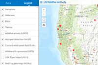
- Content: Choose to display geo-located content from Flickr, Twitter, Instagram or Webcams.travel.
- Summary: Briefly describe your application in the "Area" panel.
- Keywords: Use query keywords to search on Flickr or Twitter.
- Search: Enable Searching for addresses and places.
- Share: Share this application through Twitter, Facebook, Google+ or generate HTML for embedding in a blog or website.
- Basemap: Enable toggling between two Esri basemaps.
- Layers: Toggle visibility of layers.
- Legend: Display a legend.
- Bookmarks: Webmap bookmarks can be used to navigate the map.
- About: Display information about the application. The dialog can also be set to open on startup.
- Download and unzip the .zip file or clone the repo.
- Web-enable the directory.
- Access the .html page.
- See the readme.html page for configuration options.
New to Github? Get started here.
- Notepad or HTML editor
- A little background with Javascript
- Experience with the ArcGIS Javascript API would help.
This application uses a custom webfont created on Fontello. If you're hosting this application on your own server, make sure that it's configured to host the webfont files with the correct mime types. Some servers require a mime type set for these files to be able to serve them correctly. See the following URLs for more information. There is a zip archive of the webfont with it's fontello config in the "resources" folder in this repository.
Find a bug or want to request a new feature? Please let us know by submitting an issue.
Anyone and everyone is welcome to contribute. :)
Copyright 2012 Esri
Licensed under the Apache License, Version 2.0 (the "License"); you may not use this file except in compliance with the License. You may obtain a copy of the License at
http://www.apache.org/licenses/LICENSE-2.0
Unless required by applicable law or agreed to in writing, software distributed under the License is distributed on an "AS IS" BASIS, WITHOUT WARRANTIES OR CONDITIONS OF ANY KIND, either express or implied. See the License for the specific language governing permissions and limitations under the License.
A copy of the license is available in the repository's license.txt file.
[](Esri Tags: ArcGIS ArcGIS Online Web Application Local Impact Map template Public) [](Esri Language: JavaScript)