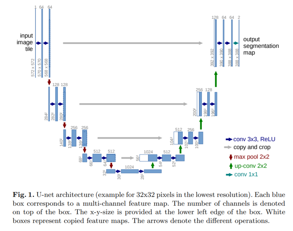
Model architecture is similar to the one presented in original paper U-Net: Convolutional Networks for Biomedical Image Segmentation, mainly in case of depth and number of features at each level. Although there is some differences:
- 3 input channels (RGB) - 1 channel orignal,
- input images resized to 224 x 224 - that results in 28 x 28 feature maps in bottleneck (572 x 572 original),
- 24 classes prediction - 2 classes in original,
- no information loss due to small padding - no padding originally
-
more channels:
-
near infrared (NIR), 750–900 nm, used primarily for imaging vegetation
-
thermal infrared, 10400-12500 nm, uses emitted instead of reflected radiation
-
night images
